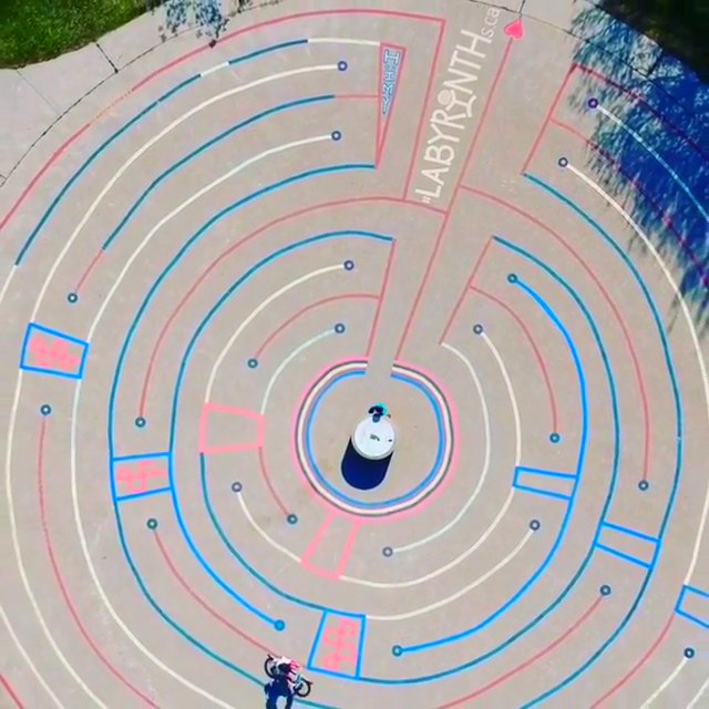
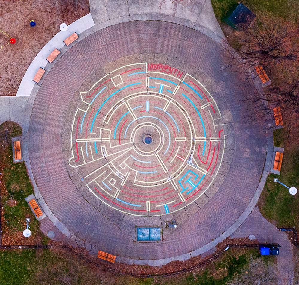
Aerial image plus short drone video of my recently repainted David Crombie Park Labyrinth . . .

Aerial image plus short drone video of my recently repainted David Crombie Park Labyrinth . . .
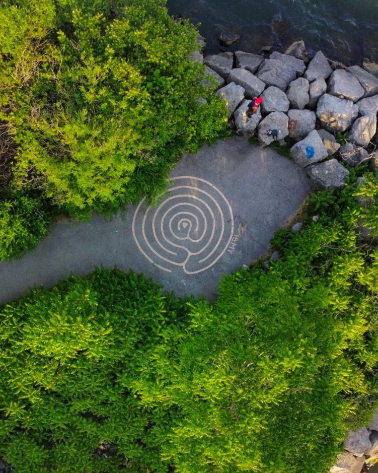
First time seeing an aerial drone photograph of my Labyrinth at the Mouth of the Humber River, south east of the Humber Bay Arch Bridge, oriented this way.
You can even spot the arrow pointing towards the entrance/exit of the Labyrinth.
AND you can easily see The Heart in the Centre !
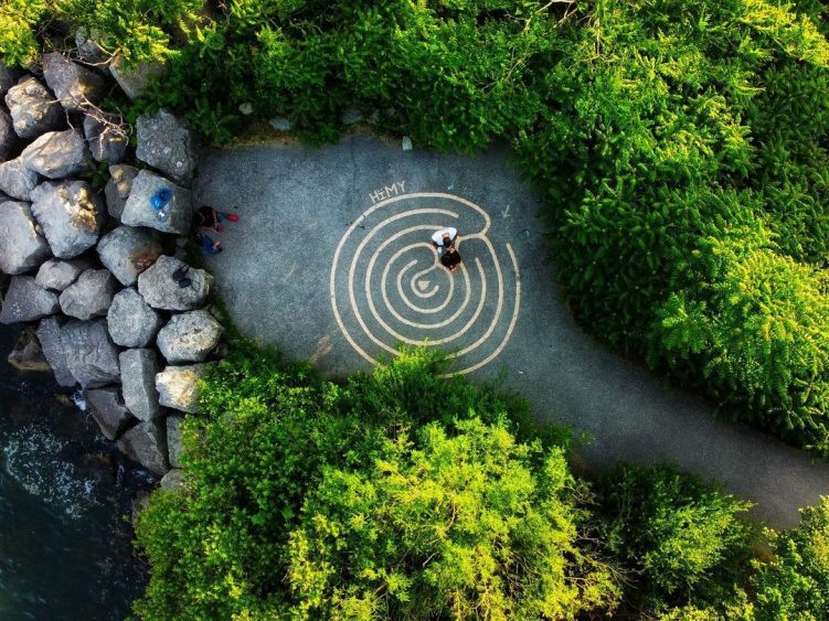
Kinda cool to see an Aerial Drone photograph of people walking my Labyrinth at the Mouth of the Humber River !
Happy time.
My Labyrinth at the Mouth of the Humber River makes a cameo.
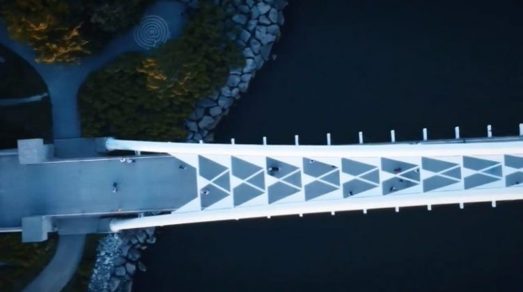
Aerial Drone Video flyover of the Humber Bay Arch Bridge dubbed to Kate Bush’s Running Up That Hill earworm made current by streaming television show, Stranger Things.
Incidentally, to get from the Labyrinth to the Humber Bay Arch Bridge, you can choose to run up a hill, seen as the desire line path in the top middle-left of the photograph above.
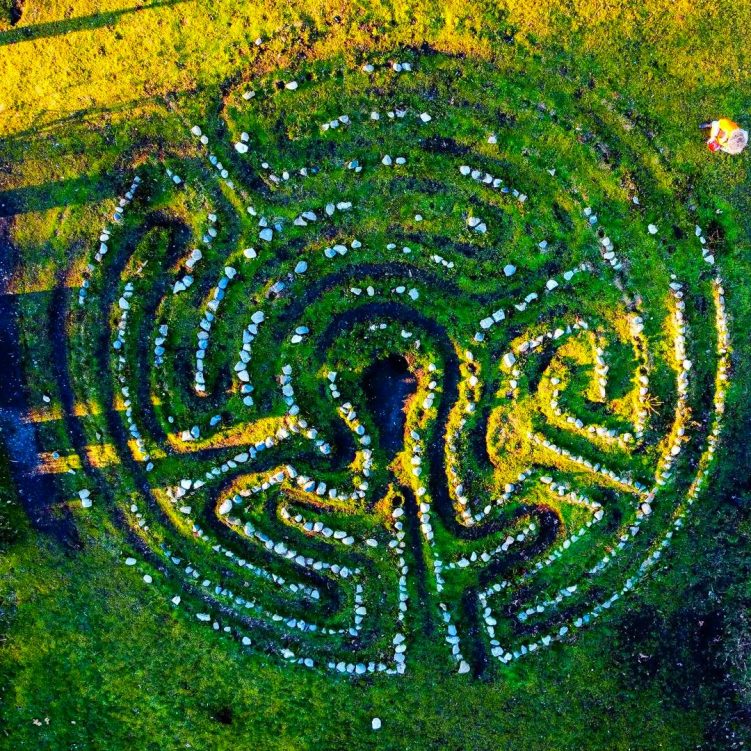
Aerial Drone image of my Vancouver Public Labyrinth.
I rotated the photograph 180 degrees so top and bottom of the Labyrinth is now north and south respectively.
Many stones have disappeared yet the well worn path remains walkable.
When I return to Vancouver, InshAllah,
The first Labyrinth I will visit and repair is this one,
The Vancouver Public Labyrinth.
” Audrey / Isaiah ”
Many, many, many, many thanks to Jordan Paul
For sharing his drone video of his children Audrey & Isaiah
Playing in my Labyrinth painted on the surface of the wading pool inside Sir Casimir Gzowski Park Playground in-between Sunnyside Boardwalk and The Martin-Goodman Trail.
Doctor Strange with the drone at my Labyrinth . . .


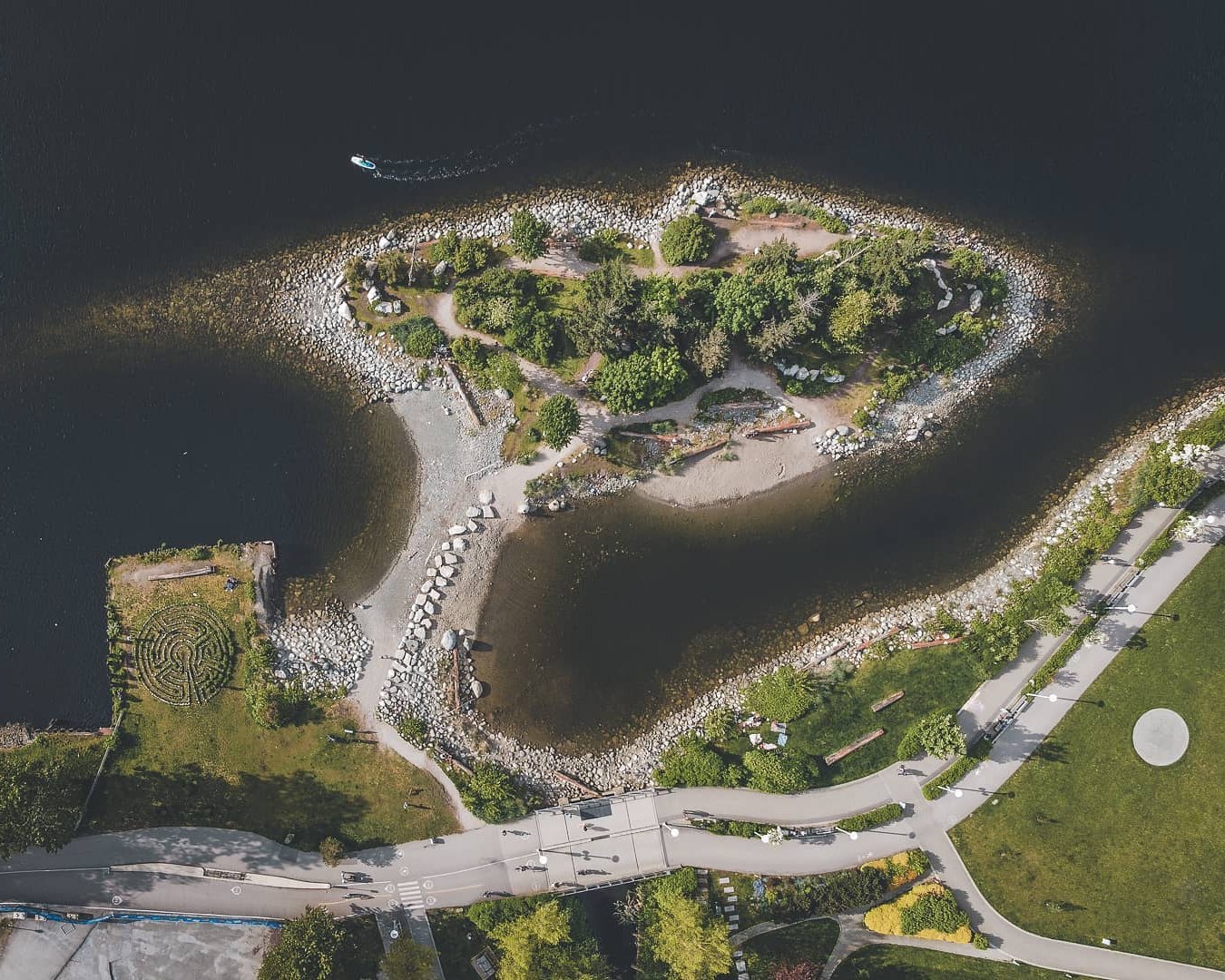
This drone image of Habitat Island captured by Vancitypixels was inspired by Jeremy Lee’s Drone Image of the same.
Like Jeremy’s drone photograph of Habitat Island in False Creek,
This image incidentally also includes TWO of my Labyrinths !
First one, Vancouver Public Labyrinth, is easily visible and shown here.
The second one is barely visible,
That’s my Green Masking Tape Labyrinth I made on the round cement art podium in Hinge Park.
This drone photograph was captured around 7 p.m. on June 6 2020.

To my knowledge,
this is the first aerial drone image of my Vancouver Public Labyrinth.
Grateful to Jeremy Lee in Vancouver for sharing his drone image on Instagram.
His intention was to capture Habitat Island,
My Stone Labyrinth being in view was a bonus.
I rotated the Instagram image 90 degrees to reflect a true east-west orientation.
Incidentally,
The round cement circle you can see in Hinge Park is the location of my Green Masking Tape Labyrinth !
My Hinge Park Labyrinth has since become a Ghost Labyrinth with barely a walkable masking tape outline remaining at present.
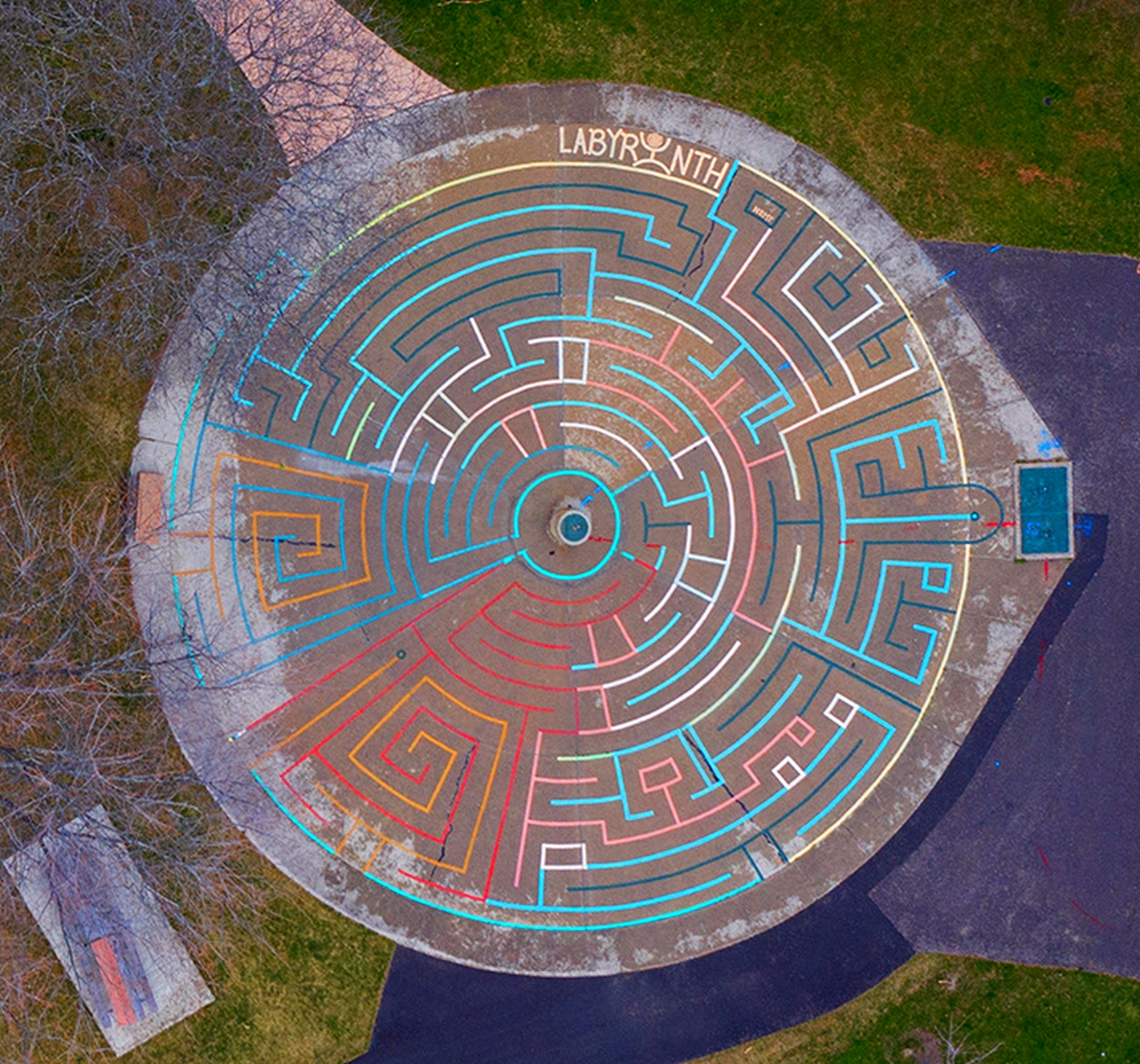
Drone Photograph of David Crombie Park’s Basketball court.
Immediately north of the Basketball court,
You can see my Green & Blue colour painted Labyrinth in the top of the image.
I’m surprised with how visible it is !
Drone Photograph of my Labyrinth on the surface of the wading pool in Earlscourt Park, Toronto . . .
Drone Photograph of my Labyrinth on the surface of the wading pool in Wadsworth Park, Toronto . . .
Looking east over David Crombie Park in Old Town Toronto towards Downtown.
Look beyond Basketball wall and you may recognize the square outline of the green and blue Labyrinth I painted there last year . . .

The opening frames of this drone video reveal a visual taste of my most recent, and most complex, 22 Lane Octagon Labyrinth in Budapest Park, Sunnyside Boardwalk, Toronto . . .