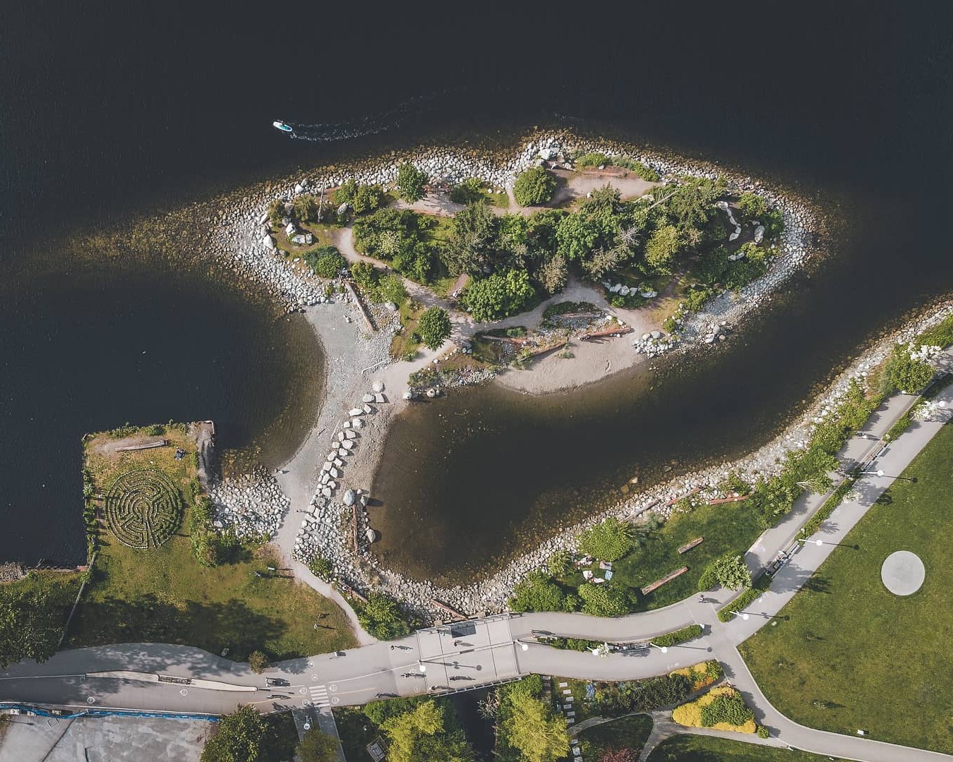

To my knowledge,
this is the first aerial drone image of my Vancouver Public Labyrinth.
Grateful to Jeremy Lee in Vancouver for sharing his drone image on Instagram.
His intention was to capture Habitat Island,
My Stone Labyrinth being in view was a bonus.
I rotated the Instagram image 90 degrees to reflect a true east-west orientation.
Incidentally,
The round cement circle you can see in Hinge Park is the location of my Green Masking Tape Labyrinth !
My Hinge Park Labyrinth has since become a Ghost Labyrinth with barely a walkable masking tape outline remaining at present.
Related Passages . . . .
At Night – Robson Square Labyrinth – Downtown Vancouver
"Городские пейзажи Ванкувера в воскресенье 😍" – Labyrinth Pier – Granville Island – False Creek Seawall – Vancouver
Twigs within The Path – Octagon Labyrinth – Wading Pool – Budapest Park – Sunnyside – Toronto
"Kodak Colorplus 200 | Olympus XA" – Labyrinth – Wading Pool – Randy Padmore Park – Downtown Toronto
"One second there was a couple in love, next second they are totally disappeared without a trace." – Labyrinth – Wading Pool – Christie Pits Park – Toronto
Labyrinth – Wading Pool – Earlscourt Park – Toronto